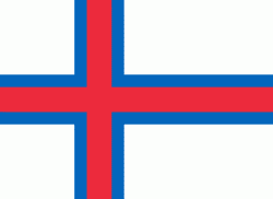
Hvalba (Hvalbøur)
Hvalba (Kvalbø) is a village and a municipality in the Faroe Islands, which consists of Hvalba, Nes-Hvalba and Sandvík.
The village spreads around the bottom of a deep inlet, Hvalbiarfjørður, in the northeast of Suðuroy.
Hvalba is one of the larger villages in the Faroe Islands. The total population of Hvalba Municipality (Hvalbiar Kommuna) was 674 as of March 2022; the population of Hvalba and Nes was 607 and the population of Sandvík was 67. The small village Nes is often called Nes-Hvalba, because there are two other villages with the same name. Nes is located on the southern arm of the fjord Hvalbiarfjørður, opposite of Hvalba. Nes does not have its own postal code. Hvalba has one supermarket, a fast food shop and a few more shops. Some of the villagers work as coalminers; Hvalba is the only place in the Faroes which still has active coalmine industry, although in very small scale. There are two harbours and some fish factories in Hvalba, both harbours are on the northern side of the bay. There is a boat harbour in Nes and a small harbour in Sandvík. The municipality plans to make a new marina between the two harbors on a place which is called Á Hamranesi. Some trawlers belong to the village, they deliver fish for the fish factory. Some people work in other villages i.e. at the Suduroy Hospital in Tvøroyri or at the Faroe Islands Ferry and Buss Transportation Company including the ferry Smyril, which sails between Suðuroy and Tórshavn, but there are also a few independent small companies in Hvalba, i.e. IT supporters, carpenters, transport company, dietitian, internet shop etc. Hvalba is located on the east side of the island but the inlet is so deep that the distance to the west coast is quite short, so the island almost splits into two islands. There are two isthmuses in Hvalba: Hvalbiareiði (also called Fiskieiði) and Norðbergseiði (also called Á Drátti). There is a memorial in Hvalba, it is located on the northern side of the fjord, just before one comes to the first harbour, not far from the bottom of the bay. The memorial is made of stone, the stone work was made by Lars and Helmut Larsen from Tórshavn, it was raised in 1963 in memory of people from Hvalba who lost their life at sea or by other accidents, i.e. by accidents in the coal mines or by falling down from the island Lítla Dímun or from one of the mountains which surround the village.
Map - Hvalba (Hvalbøur)
Map
Country - Faroe_Island
 |
 |
They are located 200 mi north-northwest of the United Kingdom, and about halfway between Norway (360 mi away) and Iceland (270 mi away). The islands form part of the Kingdom of Denmark, along with mainland Denmark and Greenland. The islands have a total area of about 540 sqmi with a population of 54,000 as of June 2022.
Currency / Language
| ISO | Currency | Symbol | Significant figures |
|---|---|---|---|
| DKK | Danish krone | kr | 2 |
| ISO | Language |
|---|---|
| DA | Danish language |
| FO | Faroese language |


